


Επίσημη διαμαρτυρία της ΝΙΚΗΣ: Πρόκληση στο OpenStreetMap - Τουρκικές διεκδικήσεις εμφανίζονται ως «θαλάσσια πάρκα»


Ποιος βάφτισε τουρκικά τα θαλάσσια πάρκα στο Αιγαίο και γύρω από το Καστελλόριζο;
Ποιος επέτρεψε μονομερείς και αυθαίρετες διεκδικήσεις της Άγκυρας να εμφανίζονται σε μια διεθνή χαρτογραφική πλατφόρμα ως δεδομένη γεωγραφική πραγματικότητα;
Η ΝΙΚΗ φέρνει στο φως μια εξαιρετικά σοβαρή υπόθεση. Στη διεθνή χαρτογραφική πλατφόρμα OpenStreetMap εμφανίζονται ως υπαρκτές θαλάσσιες ζώνες τα “θαλάσσια πάρκα” που έχει ανακηρύξει μονομερώς η Τουρκία στο Αιγαίο και γύρω από το Καστελλόριζο, αποτυπώνοντας ουσιαστικά στον χάρτη τις αυθαίρετες τουρκικές διεκδικήσεις.
Ο Αντιπρόεδρος της ΝΙΚΗΣ και βουλευτής κ. Γεώργιος Ρούντας απέστειλε επίσημη επιστολή διαμαρτυρίας προς το OpenStreetMap Foundation, απαιτώντας άμεσο έλεγχο των επίμαχων δεδομένων, αφαίρεση των μονομερών τουρκικών καταχωρίσεων και αυστηρούς μηχανισμούς επαλήθευσης.
Η διεθνής χαρτογραφία δεν μπορεί να γίνεται εργαλείο του τουρκικού αναθεωρητισμού ούτε αυθαίρετες διεκδικήσεις να αποκτούν υπόσταση μέσα από ψηφιακούς χάρτες.
Η ΝΙΚΗ ζητά άμεσες εξηγήσεις: Ποιος εισήγαγε τα στοιχεία; Ποιος τα ενέκρινε; Με ποια νομική τεκμηρίωση; Και πότε θα αποσυρθούν;
Επισυνάπτεται η επίσημη επιστολή διαμαρτυρίας του Αντιπροέδρου της ΝΙΚΗΣ κ. Γιώργου Ρούντα.
FORMAL LETTER OF PROTEST
TO:
The Board of Directors & Data Working Group (DWG)
OpenStreetMap Foundation (OSMF)
St John's Innovation Centre, Cowley Road
Cambridge, CB4 OWS, United Kingdom
Emails: board@osmfoundation.org | dwg@osmfoundation.org
FROM:
Democratic Patriotic Movement "NIKI"
Parliamentary Group - Hellenic Parliament
Syntagma Square, 105 54 Athens, Greece
DATE: September 8, 2026
NIKH
SUBJECT: Formal Protest regarding the Cartographic Inclusion of Unilaterally Declared Turkish
"Marine Parks" in the Aegean Sea ("Kuzey Ege Deniz Milli Parki") and the Kastellorizo - Megisti
("Fethiye-Kas Deniz Milli Parki") Maritime Zone
Dear Members of the Board and the Data Working Group,
We are writing to you on behalf of the Democratic Patriotic Movement "NIKI", a parliamentary
political party of the Hellenic Republic, to submit an urgent and formal protest regarding the
inclusion and public rendering on OpenStreetMap (OSM) of two maritime protected areas /"marine
parks" unilaterally declared by the Republic of Turkey in the Aegean Sea and in the sea area
surrounding the island of Kastellorizo - Megisti in the Eastern Mediterranean.
OpenStreetMap has earned worldwide respect as an open, community-driven cartographic project
aiming to deliver accurate, objective, and dependable geographic data. However, allowing the
platform to feature spatial designations that stem from unilateral geopolitical claims-devoid of any
basis under International Law-compromises OSM's integrity, neutrality, and credibility.
1. Violation of International Law and Sovereign Rights
The maritime areas in question in the Aegean Sea and around Kastellorizo - Megisti fall squarely
within zones of sovereign rights and jurisdiction of the Hellenic Republic under customary
International Law and the United Nations Convention on the Law of the Sea (UNCLOS 1982).
이
Pursuant to Article 121 of UNCLOS, islands-including Kastellorizo - Megisti and the Aegean
islands-possess full rights to territorial sea, contiguous zone, continental shelf, and
Exclusive Economic Zone (EEZ).
Although Turkey is not a party to the 1982 United Nations Convention on the Law of the Sea
(UNCLOS), a large part of the rules codified in UNCLOS also constitute customary
international law and, as such, are binding on all states, regardless of their ratification of the
www.nikh.gr info@nikh.gr facebook.com/NIΚΗ-GREECE x.com/NIKHGREECE Αθήνα: Μεσογείων 2-4, ΤΚ 11527
τηλ: 210-7470222 Θεσσαλονίκη: Πλατεία Αριστοτέλους 5, ΤΚ 54623 τηλ: 2310-232999
σ. 1/3
NIKH
Convention, including Turkey. The International Court of Justice in The Hague has repeatedly
confirmed this in cases where one of the disputing states was not a party to UNCLOS¹.
The unilateral declaration of "marine parks" by Turkey over these maritime regions
represents an abusive attempt to create a fait accompli, usurping Greek sovereign rights
under the guise of environmental protection.
• Unilateral administrative acts by a third state over another sovereign state's maritime
territory or continental shelf are null, void, and without international legal effect.
2. Cartographic Responsibility and Abuse of the OSM Platform
By depicting these unilaterally proclaimed Turkish marine parks on OpenStreetMap base layers:
1. OSM is exposed to political instrumentality: The platform is inadvertently being
weaponized to legitimize unilateral expansionist claims and cartographic revisionism.
2. Global Users are Misinformed: Displaying these disputed unilateral zones misleads
international mariners, researchers, educational institutions, and public users into accepting
illegal administrative boundaries as established geographic reality.
3. Breach of OSM Neutrality Principles: According to OSMF and Data Working Group standards
on disputed boundaries and claims, OSM must not serve as a vector for non-consensual
geopolitical propaganda that disregards international legality. Environmental tags and
spatial polygons should reflect verified legal reality or consensus, not arbitrary unilateral
decrees.
3. Demands for Immediate Action
In light of the above, the Democratic Patriotic Movement "NIKI" respectfully calls upon the Board of
Directors and the Data Working Group of the OpenStreetMap Foundation to:
1. Conduct an Immediate Review: Order the Data Working Group (DWG) to audit all recent
nodes, ways, and relations corresponding to the unilateral Turkish "marine park"
declarations in the Aegean and Kastellorizo - Megisti sea regions.
2. Remove Unilateral Features: Promptly remove or suspend these unilaterally declared
spatial polygons and associated administrative/environmental tags from all default
OpenStreetMap render layers and data exports.
3. Enforce Strict Verification Controls: Implement strict cartographic oversight to prevent
future attempts to upload unilateral maritime designations that violate UNCLOS and
established sovereign rights in the region.
1 Territorial and Maritime Dispute (Nicaragua v. Colombia) [https://www.icjcij.org/case/124?utm source=chatgpt.com], Alleged Violations of Sovereign Rights and Maritime Spaces in the
Caribbean Sea (Nicaragua v. Colombia)[https://www.icj-cij.org/case/155?utm source=chatgpt.com].
www.nikh.gr info@nikh.gr facebook.com/NIKH-GREECE x.com/NIKHGREECE Αθήνα: Μεσογείων 2-4, ΤΚ 11527
τηλ: 210-7470222 Θεσσαλονίκη: Πλατεία Αριστοτέλους 5, ΤΚ 54623 τηλ: 2310-232999
0. 2/3
NIKH
The respect for international law, sovereignty, and regional stability must remain paramount. We
trust that the OpenStreetMap Foundation will act swiftly to uphold its commitment to factual
cartographic accuracy and ethical data governance.
We remain at your disposal for any further clarifications or legal documentation required.
Yours sincerely,
Georgios Nap. Rountas,
Vice President of the Democratic Patriotic Movement NIKI and
an active member of the Hellenic Parliament
Democratic Patriotic Movement "NIKІ"
✓Hellenic Parliament
Athens, Greece




ΔΙΑΒΑΣΤΕ ΑΚΟΜΗ
-
-

-

Η ΚΕΔ δικαιώνει τον ΠΑΟΚ για τη φάση του πέναλτι
09 Σεπτεμβρίου 2026 -
-
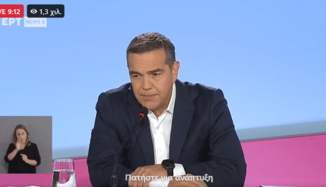
ΔΕΘ: Live η συνέντευξη Τύπου του Αλέξη Τσίπρα
09 Σεπτεμβρίου 2026

ΣΧΟΛΙΑ